marine ecological survey |
|
|
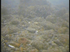
Habitat & Biotope MappingStaff at PMSL have a wide range of experience in the mapping of intertidal and subtidal habitats and analysis of biotope distribution. Such work ranges from assessment of subtidal habitats using grab, trawl or video survey (in conjunction to acoustic survey techniques) to intertidal mapping studies following standard MNCR methodologies using GPS data loggers and aerial photography in conjunction with core sampling. One of the senior staff at PMSL is a co-author of the current JNCC UK Marine Habitat Classification* and worked closely with JNCC to carry out the review of the subtidal and intertidal sediment section of the classification.
* Connor D, Allen J.H., Golding N, Lieberknecht L, Northen K, Reker J. 2003. The National Marine Habitat Classification for Britain and Ireland Version 03.02 C 2003. JNCC, Peterborough ISBN 1 86107 546 4. |
||
  
|
|||
| Precision Marine
Survey Church Farm Main Road Thorngumbald East Yorkshire HU12 9NE United Kingdom Tel 01964 624423 Fax 01964 623352 Email Us |
| Precision Marine Survey Ltd © 2009 VAT REG No. 859 6462 70 |